


General
Live a well-travelled life in style and experience authentic cuisines, indigenous aesthetics and spectacular delights in some of the world’s most extraordinary locations with Serena Hotels. Our diverse collection of thirty-five hotels, resorts, safari lodges, camps and forts.
Check-in
From 2:00 pm
Check-out
Untill 12:00 pm
Cancellation / Prepayment
Cancellation and prepayment policies vary according to room type. Please check the room conditions when selecting your room.
Payment Options
Bank Transfers & Online Payment options available in the following bank account.
- Account Title: Fly Pakistan
Facilities
This Serena Shigar Fort's Map Location is not Available yet,
For more details Please contact FlyPakistan 24/7 Customer Care Service +92 345 9668442.
Hotel Surroundings
| Famous Landmarks | Distance fro Landmarks |
|---|---|
| Shigar Valley | 0.2 km |
| Shangrila Resort Skardu | 54.8 km |
| Khaplu Valley | 102.1 km |
| Deosai National Park | 55.9 km |
Map View of Serena Shigar Fort
Hotel Score and Score Breakdown
8.1
/ 10
Based on 782 reviews
Guest reviews are written by our customers after their stay at Hotel Serena Shigar Fort
- Clean
- 8
- Comfort
- 6
- Location
- 8
- Staff
- 10
- Services
- 7
- Value for money
- 9
Guest reviews
-

Hello World! https://racetrack.top/go/giywczjtmm5dinbs?hs=ab4023f17fb3239570bac04833dbde13&
ayfkuh@tofeat.com
2023-04-110/ 10 lvbvvk
srtul9
Shangrila Resort Skardu
Kachura, Skardu • Show on map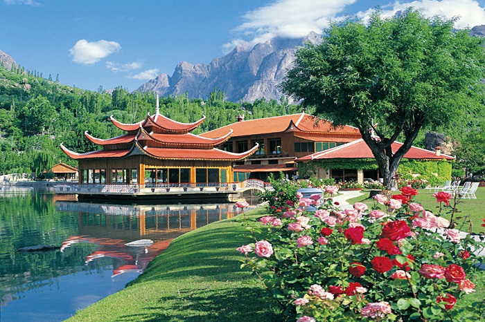
Shangrila Resort, also known as "HEAVEN ON EARTH" nestled amongst some of the worlds highest peaks. It encircles the heart shaped Kachura Lake.
Shangrila was established in 1983 with the opening of the first Resort Hotel in Skardu, Gilgit-Baltistan, Pakistan. Shangrila Resort Hotel was founded by the late Muhammad Aslam Khan Afridi, the first commander of the Northern Scouts of the Pakistan Army. The resort is known for its restaurant that is built on the fuselage of an aircraft that had crashed nearby. Shangrila was named after a book titled Lost Horizon by James Hilton. In the novel, the author narrates a tale in which an airplane crash landed near a riverbed, in the early 1920s. The surviving passengers came across some Buddhist monks from a nearby temple and sought their help. They were taken to a beautiful lamasery filled with a variety of fruits and flowers.
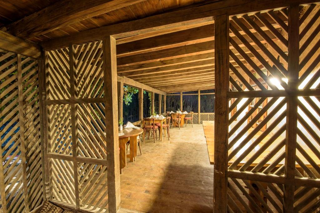
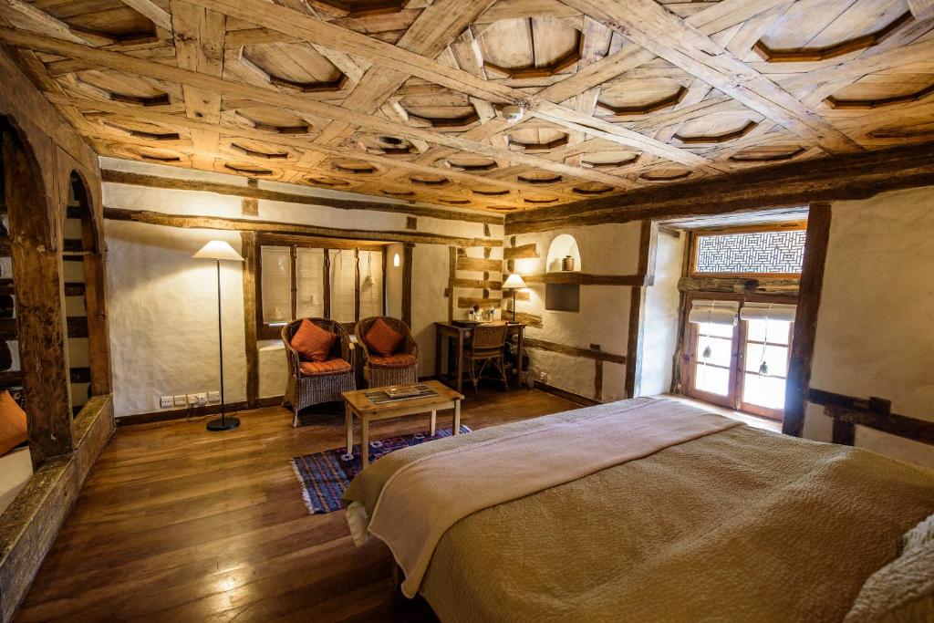
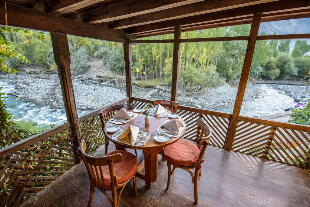
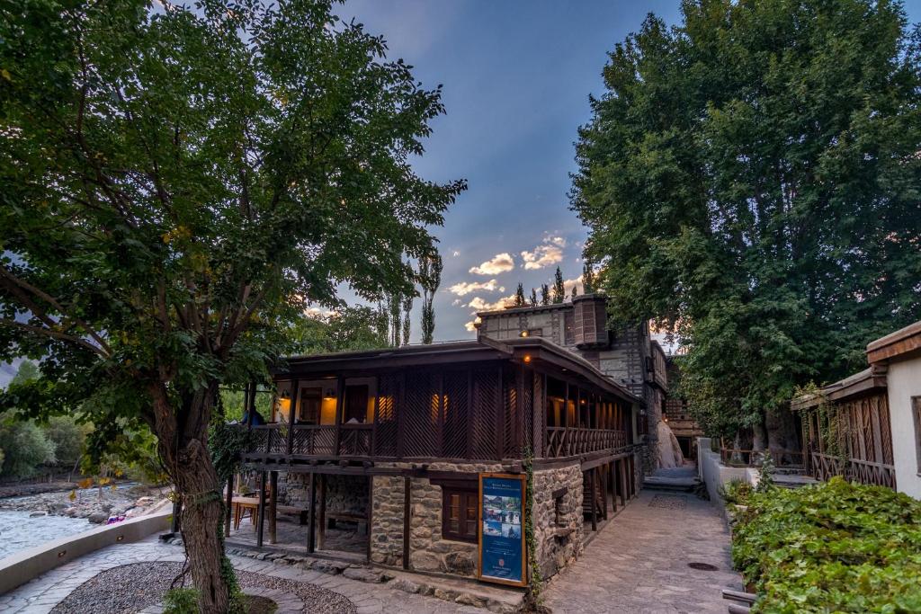
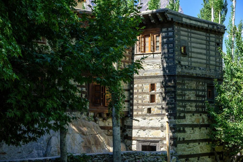
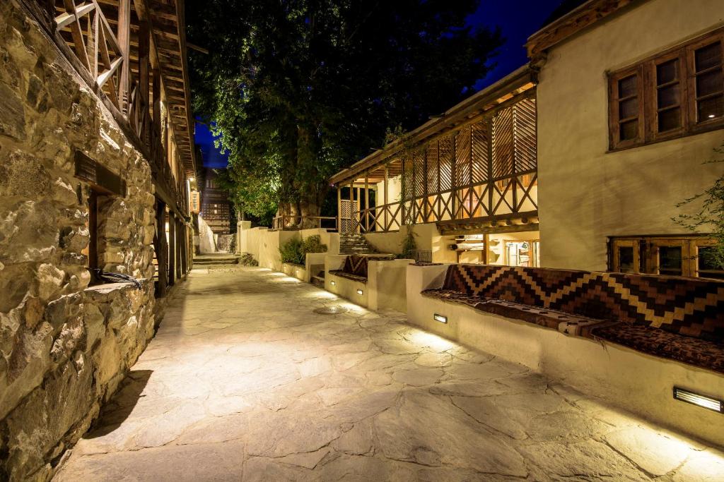
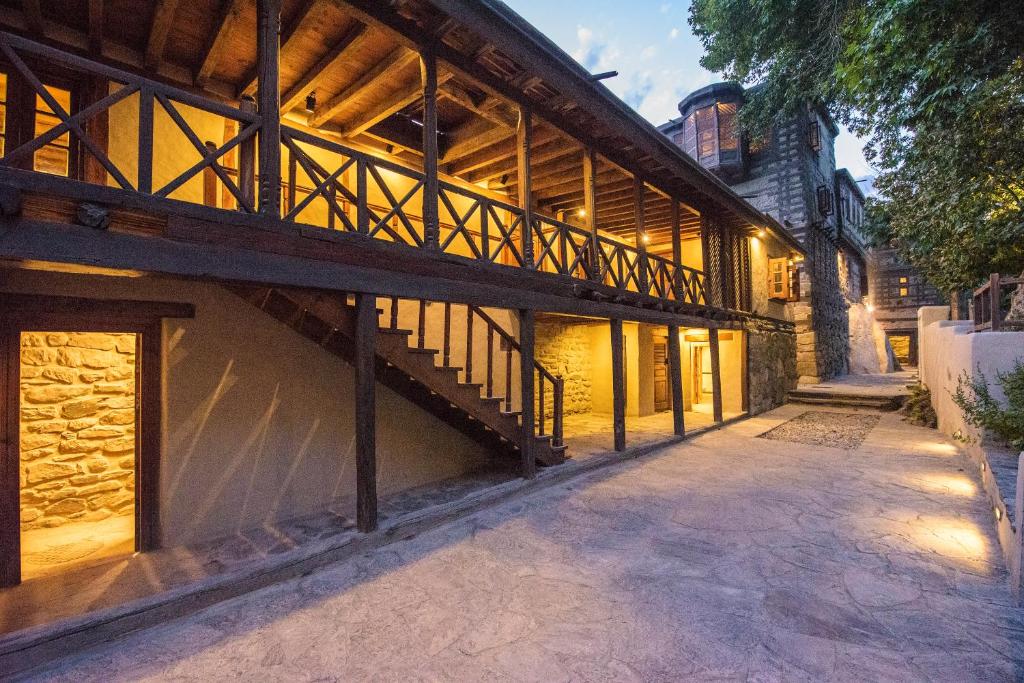
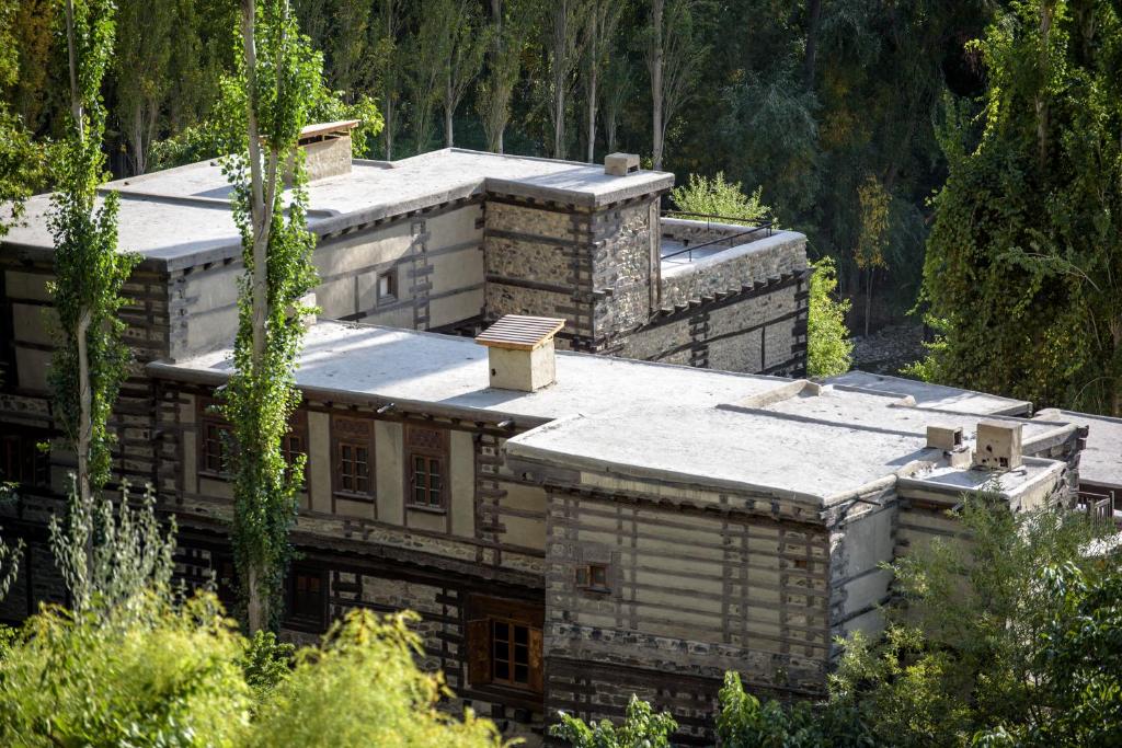
Shigar Fort
Serena Shigar Hotel, Shigar, Baltistan, Pakistan, Shigar, Gilgit-Baltistan 16300 • Show on map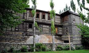
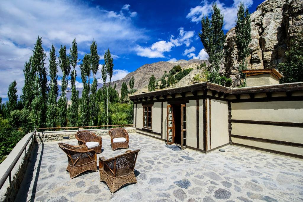
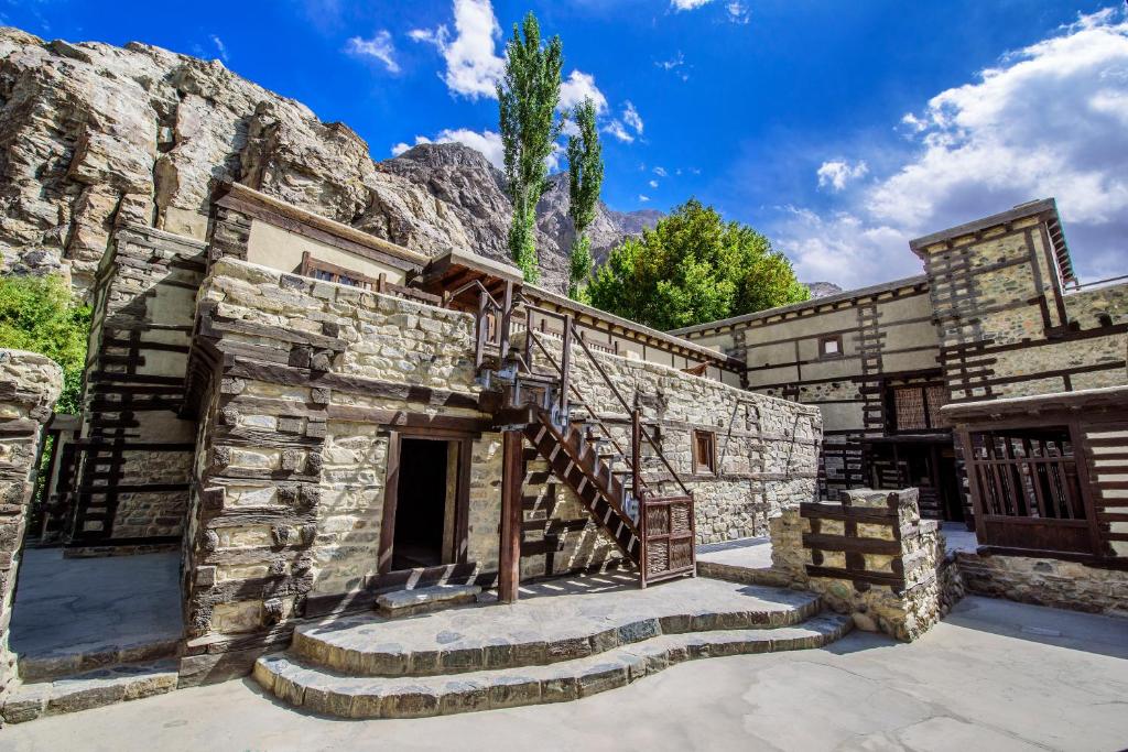
Shigar Fort is a Heritage Place located in Shigar valley. The Shigar Fort means The Fort on Rock is an old fort of Baltistan and Pakistan located in the town of Shigar. It was built in the 17th century by the Raja of Amacha Dynasty of Shigar.
Shigar Fort is operated By Serena Group of Hotels. Shigar fort is Located at a height of 2,250 meters, Shigar Fort is located 30 kms from Skardu town. Graced by the extreme beauty of Baltistan’s Karakoram Mountain Range and four centuries of folklore and legends, Serena Shigar Fort is a one-of-a-kind heritage boutique hotel situated within a peaceful natural setting. Seek refuge and find adventure in a 400-year-old fort and the 17th century Palace of the Raja of Shigar, which, along with the more recently added "Old House" and "Garden House,"
Deosai National Park
Deosai Park Rd, Astore, Gilgit-Baltistan • Show on map
Deosai National Park is a high-altitude alpine plain (plateau) and National Park located in between Skardu, Astore, and Kharmang districts in Gilgit Baltistan.
Deosai is one of the most popular tourist destinations in Skardu. The Deosai National Park was created to protect numerous animal and bird species, including the Snow Leopard, Red Fox, Himalayan Brown Bear, Wolf, Golden eagle, Sparrow Hawk, and Snow Cock. In addition, this park is renowned for its luxuriant flora and fauna, streams, green meadows, snow-capped mountains, and dense wildflowers. The National Park is only visited during the summer when a breathtaking display of flowers and butterflies greets visitors. However, Bara Pani, Sheosar Lake, Burgi Land, Ali Malik are all great locations to visit in Deosai. No doubt, Deosai is one of the most popular tourist destinations in Skardu.
Upper Kachura Lake
Skardu, Gilgit-Baltistan • Show on map
The Kachura Lakes are three lakes in the Skardu District of Gilgit-Baltistan, northern Pakistan.
Upper Kachura Lake has water that is clear and is 70 meters deep (230 ft). The temperature is 15 °C (59 °F) in the summer. During the winter, the surface is solidly frozen. A lower part of the upper Indus River flows nearby. Due to its rough terrain, there isn't much infrastructure around the Upper Kachura Lake, so most tourists don't go there. This means that most people haven't seen its beauty. The Western Himalayan subalpine conifer forest ecoregion has a lot of plants that live in the area, and the area is also known for its wild apricot (Prunus armeniaca) orchards. At Upper Kachura Lake, people can go for Himalaya mountaineering, hiking, and trout fishing.
Manthokha Waterfall
Madhupur - Mantho Road PO Manthokha Kharmang • Show on map
It is located in the village of Manthuka Kharmang in Skardu, Gilgit-Baltistan, this waterfall is famous for its picturesque landscape.
This is one of the most popular tourist spots in Skardu, welcoming both internal and overseas visitors. The waterfall is located in the village of Manthokha, which is accessible from the city of Skardu. From Skardu, one must continue the Kargil-Skardu route to reach Manthokha Waterfall. The Kargil-Skardu road passes through the following villages en route to Manthokha: Thorgo, Hussainabad, Parkutta, Manthokha, and Ghasing. A stream that is moving downstream eventually enters the Indus River at the village of Manthokha. You will find Madhupur on the eastern bank of this stream. The route that connects Manthoka and Madhapur will take you to your ultimate destination.
Satpara Lake
Satpara Lake road, Skardu • Show on map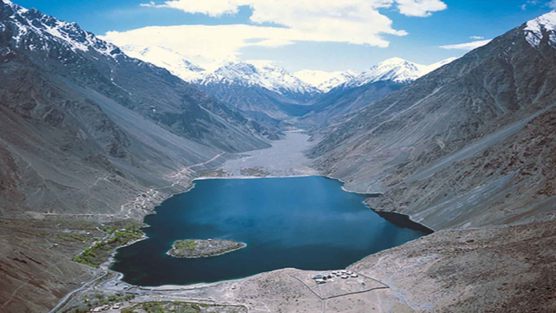
Satpara Lake is situated at a height of 2,636 meters 8,650 feet above sea level and is spread over an area of 2.5 km².
The alternative name for Satpara Lake is Sadda Lake. Satpara Lake is a natural lake located close to Skardu, Gilgit-Baltistan, Pakistan that provides water to Skardu Valley. The Satpara Stream brings water to it. Since 2003, Satpara Dam has been built just below the lake, which will increase the size of Satpara Lake once completed. It plays an important role in the town of Skardu as a source of water supply. It is spread over an area of 1.55 miles (2.5 kilometers). In the middle of the lake sits a beautiful island reminiscent of a fairy tale. A country boat can be used to access the island. Locals believe there is a gold mine at the bottom of this lake, according to a well-known urban legend.
Kharpocho Fort
Chumik Rd, Skardu, Gilgit-Baltistan • Show on map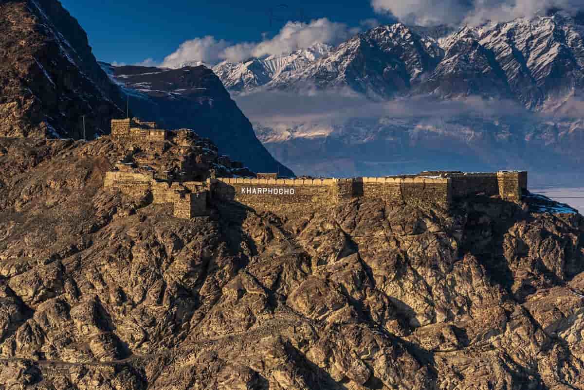
Skardu Fort or Kharpocho means The king of Forts is a fort in Skardu city in the Gilgit-Baltistan region of Pakistan.
Greg Child, an Australian mountaineer, and filmmaker said the fort is "perched above the junction of the rivers" and has a view of the Rock of Skardu. At the end of the 1600s, Ali Sher Khan Anchan, who was king at the time, built the fort. General Zorawar Singh, a member of the Dogra Rajput clan, recognized the significance of the fort's placement in the town while working for Maharaja Gulab Singh. As a result, he occupied the fort. As part of his several military expeditions, Baltistan was annexed to the princely state of Jammu and Kashmir. The fort was destroyed in 1857 under the direction of Ranbir Singh.
Sheosar Lake, Skardu
Situated in Deosai National Park, Gilgit-Baltistan, Pakistan. It is located at a height of 4,142 meters (13,589 ft). • Show on map
Sheosar Lake is an alpine lake situated in Deosai National Park, Gilgit-Baltistan, Pakistan. It is located at a height of 4,142 meters (13,589 ft).
As you explore the large plains of Deosai, you will come across the beautiful Sheosar Lake in the middle of the plains. At an altitude of 13,589 feet above sea level, this lake holds the record for the greatest elevation of any lake of its sort in the world. A mesmerizing scene is created by the deep blue water that is surrounded by the verdant plains of Deosai. And in the background, you will find the formidable mountains of Nanga Parbat. Each season at the lake has its own beauty. In the winter, the lake is frozen, and in the summer, its many colors captivate visitors.
Lower Kachura Lake Shangrila
Lower Kachura Lake, Skardu • Show on map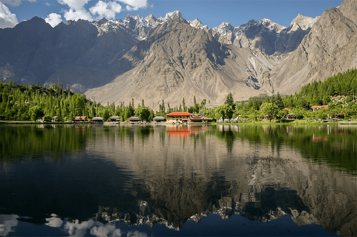
Lower Kachura Lake, also known as Shangrila Lake, is a lake located close to the Pakistani city of Skardu in Gilgit-Baltistan. Since 1983, a resort (Shangrila Resort) has been operating on its bank, which is situated at a height of 2,500 meters (8,200 feet).
The Heavenly Shangrila Resort is situated 35 minutes from Skardu on a gorgeous lake and is surrounded by breathtaking scenery. This resort is primarily renowned for its Skardu boat rides. On the edge of Lower Kachura Lake is where you'll find this beautiful resort. In addition to that, it is well-known in Skardu as a location for picnics. The Shangrila Resort, popularly known as "HEAVEN ON EARTH," is located in a location that is surrounded by some of the highest peaks in the world. It encompasses the lake in the shape of a heart. The resort is well-known for its restaurant, which was constructed on the fuselage of a plane that had crashed in the area.
Sarfarangah Desert
Sarfaranga Desert, Chumik Rd, Chomik, Skardu • Show on map
The Cold Desert located in Sarfaranga village in Skardu, Gilgit-Baltistan is the world's highest desert with an altitude of almost 1000 feet.
One of the two most well-known icy deserts in the area, the Sarfarangah Desert is located close to Skardu. Because of its location in the Shigar Valley along the Shigar River, it serves as an excellent capstone experience for a trip to the Shigar area. So when you visit this beautiful place put your shoes in the sand as the sand is smooth and enjoyable without shoes. Caution is advised, though, as there is a possibility that there are thorns buried beneath the sand in some areas.
